98 miles. Total Ascent 19,360 feet. Total Descent 17,930 feet. -5 days July 17-21, 2024
I completed this section in 5 days. I had originally planned on arriving at White Pass mid-day on the 6th day, but I was able to walk farther than I estimated. In several cases, the places where I planned to spend a long lunch break or stop for the day were not inviting due to bugs (mosquitoes, yellow jackets or flies), so I cut my break short and kept walking. In other cases, I arrived at my planned campsite early in the afternoon and had energy to continue further.
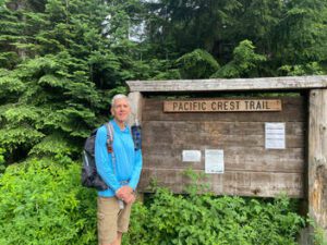
My original plan was to start at the Oregon/Washington border and walk north on the Pacific Crest Trail (PCT), but this changed due to a close contact with a Covid positive person two days before my planned start date. After considering various options, I settled on postponing the start day by a couple of days to see if I would become symptomatic and to start closer to home to minimize travel before starting and to make it easier to return home if I got sick the first day or two after starting. Luckily I stayed healthy. An added benefit to the trip revision was that at the time I started hiking it was cooler at Snoqualmie Pass (just east of Seattle) than it was at Cascade Locks (town on the Columbia River adjacent to the Bridge of the Gods (where the PCT crosses the Columbia River).
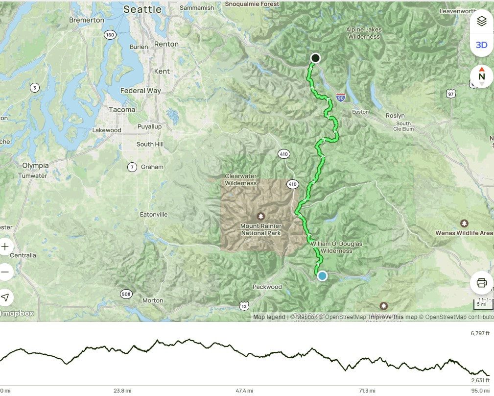
Day 1: Snoqualmie Pass to a couple miles shy of Stampede Pass. 16.3 miles Total assent 4058 ft. Total descent 3,183 ft.
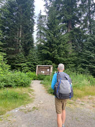
Angie and I left our house around 7:00 am and drove the hour and fifteen minutes up to the southbound trailhead at Snoqualmie Pass. I was pretty nervous as this was the first time I have ever attempted a backpacking trip of this length. Prior to this trip my longest solo trip had been just two nights and three days. This was also my first time out with much of my gear as I had changed out much of it to lighter options. I’m not sure exactly how much the new gear lightened my pack, but I suspect I cut 6 lbs. or so from my base weight (pack weight without food). I had a new pack, tent, and sleeping system, which were each much lighter than their predecessors. Contrary to established wisdom, I hadn’t yet tried them out in the field. My pack with 5 days of food and two liters of water weighed 29 lbs, which I thought was pretty good, though I would have been happier if it had been even lighter.
I was pretty much ready to go once we parked the car, so after a few pictures and making a quick Facebook post to let others know that I was starting an adventure, I started down the trail. I looked back and saw Angie in the car getting ready to head home and wondered where and when I’d see her again and what I’d experience in the intervening hours and days.
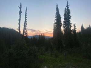
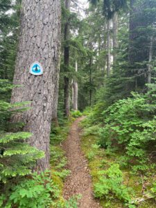
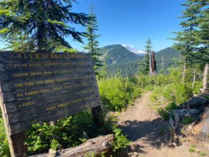
The trail winds its way up the ski slopes before entering forests and offering a last view down Interstate 90. The trail eventually crossed a dirt road before continuing on to Mirror lake, a popular day hike destination, which I had previously hiked with a friend. I filtered water (the first of many times) at Mirror lake and then followed the trail as it descended into the Cedar River valley. Signs along the trail made sure to let hikers know of the protected status of the watershed. I had planned to stop at a creek after about 13 miles, but I still had some energy and daylight left when I got there so I continued on for another 3 miles. The sky clouded up and it rained for 10-15 minutes after I got my tent set up. I boiled water for my freeze-dried dinner, cleaned-up and was in bed before it got dark. I didn’t sleep great and could tell I still had a fair amount of nervous energy, but I felt sufficiently rested when morning came.

Day 2: Stampede Pass to south of Tacoma Pass. 17.4 miles Total assent 4,742 ft. Total descent 3,639 ft.
I woke up with daylight around 5:00 am. It took me an hour and fifteen minutes to break camp and have breakfast so I was walking by 6:15 am. I started the day feeling pretty well, but after a couple hours of walking I started to feel tired and had a bit of an upset stomach. Luckily that didn’t last long and I was soon feeling fine again. This seemed to be a fairly regular occurrence where it took me an hour or two to fully wake up in the morning and hit my stride. It also helped to eat something every couple of hours to keep my energy levels up. I had seen three southbound PCT hikers yesterday an was passed by 6 more PCT south bound (SOBO) hikers today. They had started at the Canadian border at the end of June or very early July and experienced a lot of snow on the trail the for the first week or two as well as unusually warm temperatures. I would cross paths with them several times over the coming two weeks. I have not seen any north bound through hikers yet. I crossed Tacoma Pass around mid day and made it to a stream which was the last water for a twelve mile stretch. I was too tired to cover the 12 miles and 2,000 feet of elevation gain in what was left of the day, so loaded up with 4 liters of water and made it to a campsite that was 5 miles and 800 feet in elevation gain. It was only 3:45 pm, but I had already done a lot of climbing and I was too tired to go any further so I made camp for the day. The campsite had room for several tents, though none of the sites for tents were perfectly flat. At about 8:00 pm, two other people arrived and quickly set up their tents. They were pretty quiet and quick setting up their tents, and I soon heard the person closest to me snoring. I could hear her moving around throughout the night. I am sure that she could also hear me move as one of the drawbacks to using an air mattress instead of a rigid foam pad is that air mattresses tend to be noisy when shifting positions.

Day 3: South of Tacoma Pass to south of Arch Rock trail. 22.4 miles Total assent 4,343 ft. Total descent 3,575 ft.
I woke around 5:15 and was as quiet as possible packing up. I discovered that the trees surrounding the campsite dripped sap throughout the night such that the rainfly on my new tent was sticky with bits of sap stuck to it! The two women who joined the campsite last evening started to move around as I was preparing to leave. The one closest to me let her friend know that she had been visited in the night by a mouse who had chewed a hole in her ursack (a bear proof Kevlar food bag) and eaten some of food. It was nice to start walking, especially since today was the first day of the Cascade Crest 100, a two-day extreme running event where there would be runners on part of the trail. I had passed a few people that were marking the trail yesterday and was not looking forward to meeting a bunch of runners on the trail. Luckily, I passed the junction where the runners would be joining the PCT before any of the runners got there.

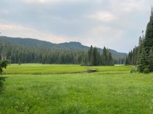
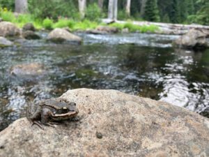
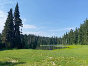
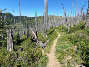
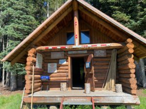
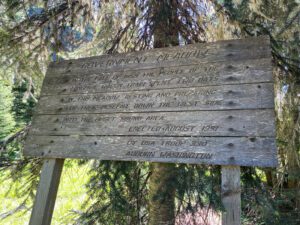
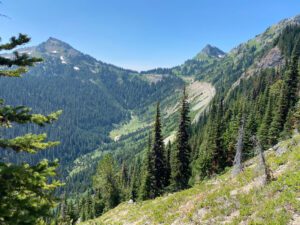
The day’s hiking took me around around several ridges, through an old burn area, down to Government Meadows and log cabin that was built by a snow mobile club, and back up another ridge and into another area that had burned years ago. It was interesting to walk through a burned forest and see just how slowly it recovers. The wildflowers seemed to be in full bloom and added splashes of color to an otherwise drab landscape, although I could never get a photo that adequately showed the wild flowers. It was very hot and dry through the second burn area as I traveled through it mid-afternoon. I camped at the end of a forested section and needed to carry water with me for several miles as the trail didn’t cross a spring until I had been hiking for several hours the next morning.

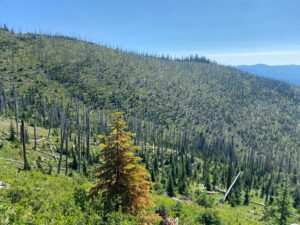
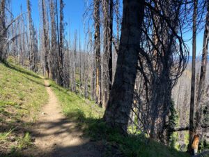
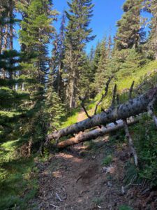
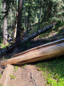
This section of the trail was one of the first with quite a few blow downs. Some were easier to navigate around than others. What started out as a novelty soon became a fairly regular occurrence on this section of trail and several sections further down the trail.
Day 4: South of Arch Rock trail past Chinook Pass to the junction with American Lake. 19.8 miles Total assent 3247 ft. Total descent 3,644 ft.
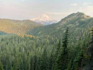
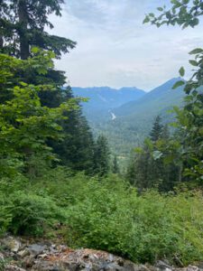
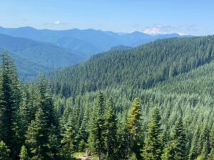
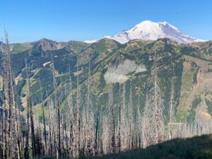
I slept well last night. I think I am getting used to the routine and sleeping outside. Perhaps my tiredness is catching up with me. I was hiking by6:15am and enjoying the early morning light and coolness, especially since I had several miles of burn area to travel through. The rest of the morning was spent traversing several ridges and making my way to Chinook pass. The views were very nice, but hard to capture with my iPhone camera. The views of Mt. Rainier were particularly impressive as I got closer and closer to the mountain.
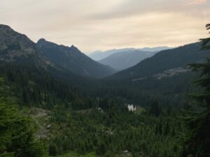
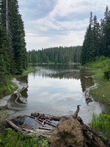
Chinook pass was crowded with day hikers and clueless parents letting their kids walk off trail and over fragile alpine meadows. I made may way to Dewy lake and decided to keep walking to see if I could get away from the crowds and mosquitoes. I lost the crowds, but the mosquitoes got worse. As the sun was setting and I was laying in my tent safe from the mosquitoes, I started to hear a high pitch noise. Not long afterward, I could see bats swooping in close to my tent before flying away. I was happy that they were hunting the mosquitoes, though it wasn’t long before the mosquitoes disappeared for the night.


Day 5: Junction with American Lake to White Pass. 22.2 miles Total assent 2847 ft. Total descent 3775 ft.
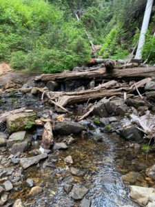
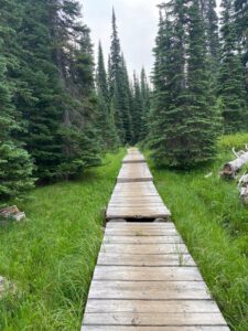
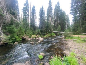
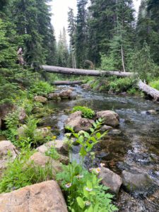
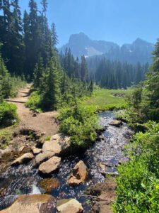
For the most part, today was another nice weather day. It did cloud up mid-afternoon and rained for about 10 minutes. Even though it rained kind of hard, it was short-lived and I stayed dry watching in while sitting at the base of a large fir tree. The trail traveled down, then up and back down a valley to White Pass. The valley was full of low lying lakes and the mosquitoes were particularly bad through this section. I was hoping to camp by water and have time to wash my clothes and body, but the mosquitoes had other plans, so I just kept walking and made it all the way to White Pass by evening. I did have a nice long morning break at Bumping River where I was able to wash a pair of socks and soak my feet in the cold river water.