General Info & Day 1
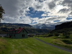
The Amarok Adventures Hidden Trails of Iceland is advertised as a 12-day trip. It consists of 10 days of hiking in Iceland’s Highlands and two half days of traveling to the Highlands from Reykjavik and returning to Reykjavik. I joined the August 18-29, 2025 trip. The group met at 3:00 pm on the first day and had a brief orientation and introduction session at Amorak’s Reykjavik location before loading into in a van and driving about two hours to Hvolsvollur, a town on the ring road in south Iceland that is near several access points to the Iceland Highlands. We had dinner and stayed at Midgard basecamp, an all-in-one restaurant/lodging/and adventure tour company. There we enjoyed a nice dinner, short soak in the roof-top hot tub, and slept in bunkbeds. Each bed had a privacy curtain, power outlets, and a reading light. I thought they were comfortable and I slept well. As it turned out, they were the best sleeping arrangements we had on the trip.
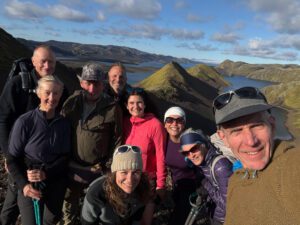
The maximum group size is 12 and most of Amarok’s trips are sold out months in advance. However, our group was only 8 as there apparently were cancelations that were notable to be filled. Our group consisted of a retired couple from Australia, two solo women travelers from Canada, an older woman from Colorado, a general contractor from North Carolina, a retired tropical forest biologist from Hawaii, and myself. It was an interesting group and as we learned more about each other, we learned that we were a group with varying levels of hiking experience, physical fitness, work experience, and political views.
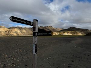
Day 2 Landmannalauger
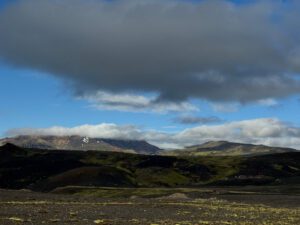
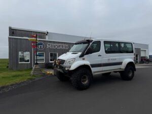
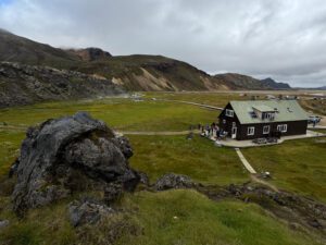
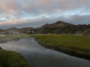
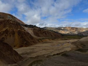
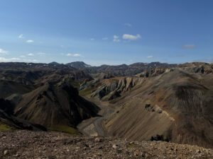
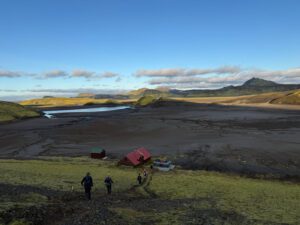
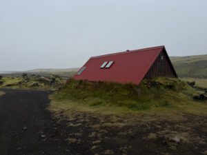
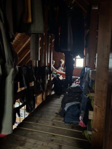
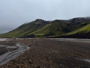
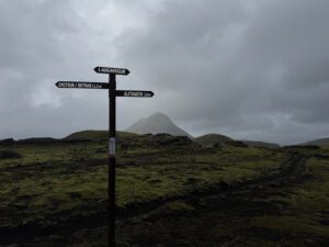
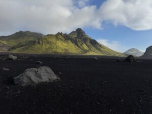
The next morning we loaded up into a 4 wheel drive van with oversized tires and set off for Landmannalaugar, in the heart of the Highlands. Landmannalaugar is the usual start of the Laugevaur trail and is popular destination for hikers of all sorts. There is a large hut that can accommodate 78 people in very tight quarters. This is were we stayed. The “hut” was a large wood-framed building with a relatively small entry way where boots were kept and that lead in to a communal kitchen with tables for about twenty people and a series of large rooms where people slept. Lucky for us that we had a few extra spaces as a result of the four canceled spots as I don’t think I would have fit in the allotted space as it wasn’t quite long enough to accommodate someone of my height (6’4″). There is also a natural mineral hot springs at Landmannalaugar, which was a popular spot, especially in the afternoon when people were done with their daily activities. I visited the hot springs multiple times and enjoyed it the most early in the morning when it was must quieter and peaceful.


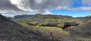
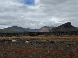
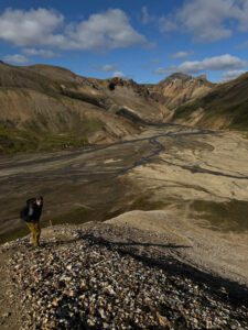
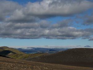
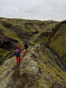
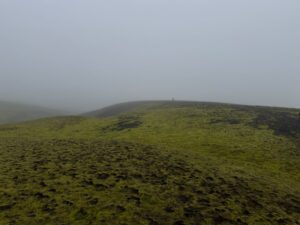
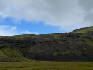
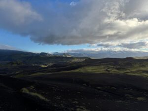
We spent two days and nights at Landmannalaugar. On the first afternoon we went on a short loop hike to the summit of Mt. Blahnubur (Blue Peak). It was just under 7 miles and was both very steep in sections and very scenic. I suspect Amorak uses this as a kind of shake-down hike so they can gauge the fitness level of the participants and to give the participants a taste of what walking over lava is like. We didn’t have the best weather at the start of the hike, but it cleared up a bit later in the day and the views were nice. It was good to get out walking.
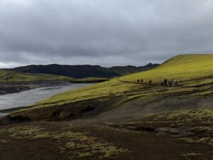
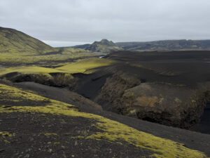
Day 3 Day hike Grænihryggur
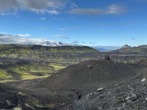
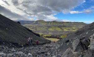
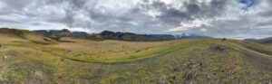
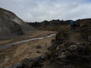
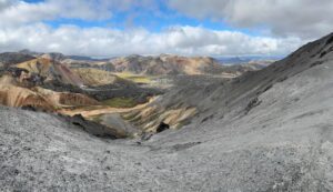
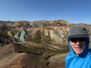
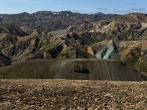
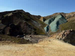
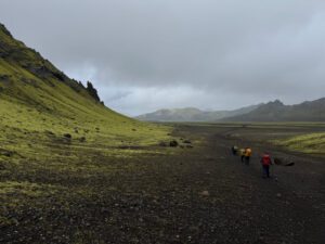
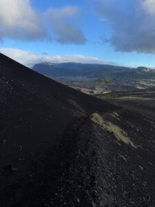
Today was another day hike from the general area of Landmannalaugar. We took a short drive to the tailhead for Grænihryggur, a 16 km out and back hike (my phone clocked in at just under 13 miles) to a green ridge of rhyolite with small quantities of divalent iron which result in its unusual color. We were short two of our group as one of the women from Canada was not feeling well and the man from North Carolina said his knee was quite sore after yesterday’s descent. Our small group of seven headed off on for a beautiful day of hiking. Upon returning we enjoyed a soak in the thermal pool and I then learned that women from Canada thought she had a head cold. She said she didn’t think she had Covid. In any case, I did my best to keep my distance, but it was generally futile as we were eating and sleeping together in fairly close quarters.
Day 4: drive to Sveinstindur hut and day hike Fögrufjöll ridge
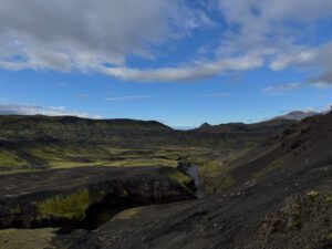
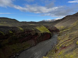
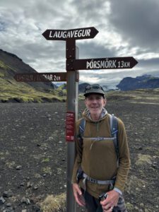
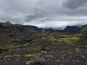
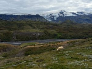
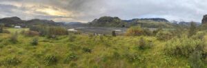
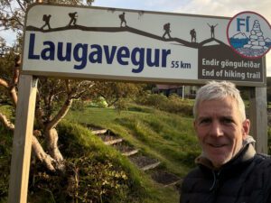
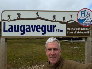
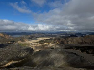
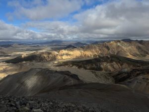
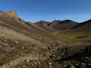
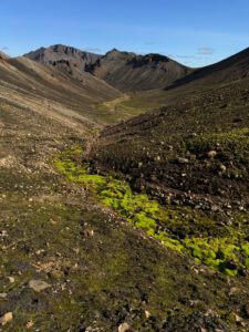
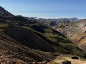
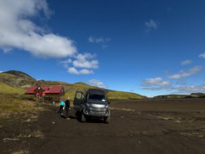
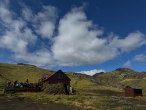
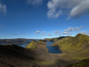
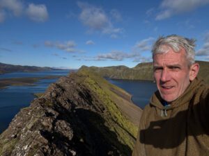
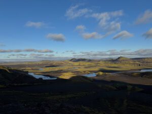
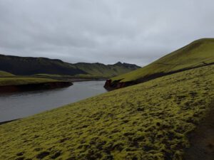
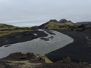
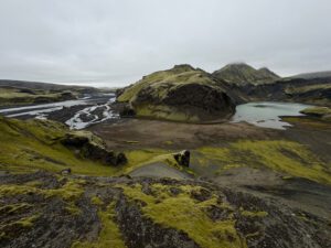
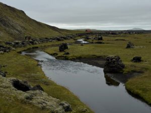
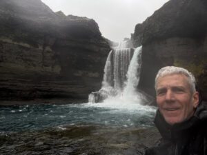
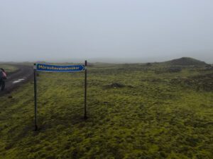
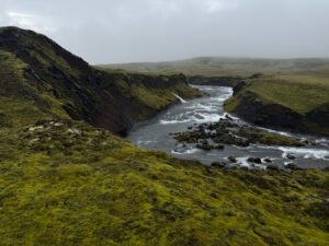
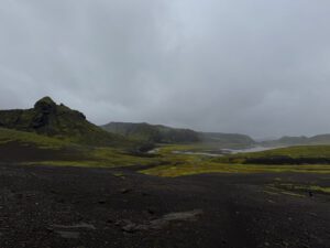
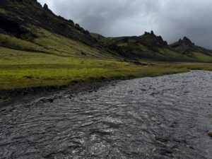
We had the morning free at Landmannalauger while we waited for a public bus from Reykjavik to arrive. On that bus, was a driver who would take us to the next hut deep in the Highlands and then return the 4WD van back to Reykjavik. I used the free time to walk a bit of the Laugavegur trail up to some steam vents. Once the public bus arrived we loaded up and drove for an hour and half or so to the next hut. Sveinstindur hut is a much smaller hut (says it sleeps 18) where we were the sole occupants. After placing our gear in the hut and having some lunch we set out on another day hike out to the Fögrufjöll ridge, which roughly translates to beautiful mountains. The weather cleared in the afternoon for what was probably the best day of hide of the trip, with views of Lanjisjor lake and Vatnajokull glacier. My phone said I had walked just under 13 miles for the day.
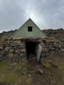
Day 5: Sveinstindur hut to Skælingur hut
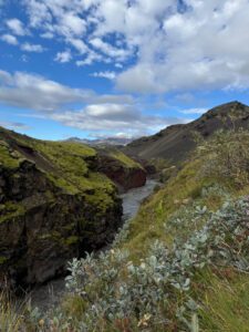
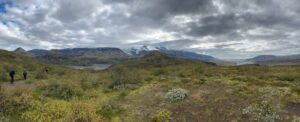
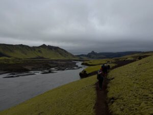
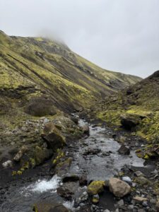
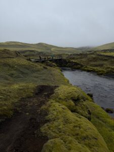
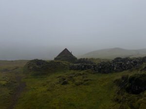
Today was the first day for us to carry our full backpacks. We set off after breakfast and walked down the road for a bit, before connecting to a trail which paralleled the Skafta river. The trail was very steep in places which was quite challenging for some people in our group. We had our first two stream crossings, before departing from the river and hiking up a narrow canyon. We then connected to another canyon that lead us down to the next hut. It was another smallish hut where we were the only ones present. It was overcast all day, but we were able to see off into the distance and we stayed dry until just before arriving at our destination for the day –Skælingur hut. My phone registered 10.4 miles for the day.
Day 6: Skælingur hut to Hólaskjól
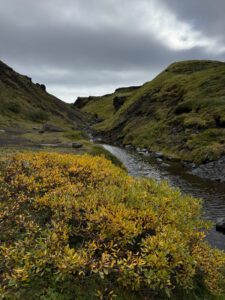
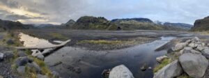
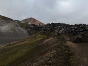
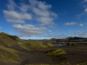
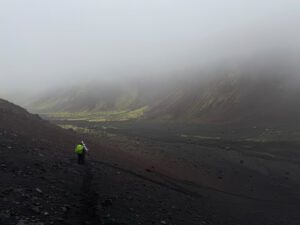
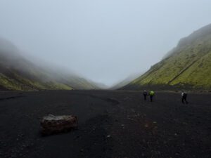
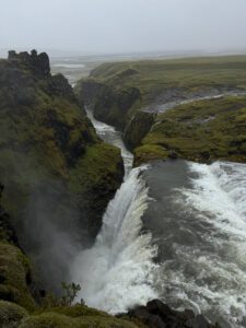
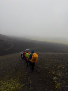
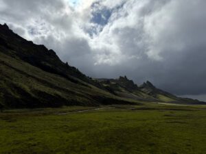
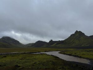
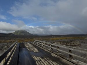
We awoke in heavy clouds and a light drizzle. And I woke up with a headache and sore throat and feeling a bit lethargic. I let the group know and tried to stay out of the way at breakfast and while putting together our sandwiches for lunch. No one seemed overly concerned as the day wore on. I didn’t really notice any additional symptoms as the day progressed, though I did do my best to stay distanced from others. Today was the first day of wearing full rain gear and having our pack covers on all day. Somehow, we all managed to have different color rain covers and the colors really stood out against the grey sky and black and green ground. We started the day walking up to a ridge that was quite windy. We then dropped into Eldgja canyon. Eldgja or “fire canyon” is a segment of a 75 km long volcanic fissure and is the largest volcanic canyon in the world. Unfortunately, the visibility was so poor that we could not see across the canyon or the bottom from the top. Once on the floor of the canyon we could only see several hundred yards in front of us.
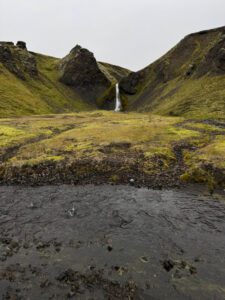
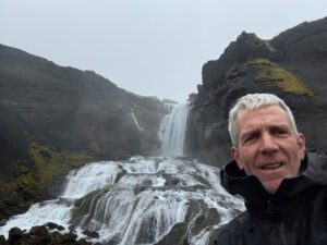
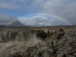
We eventually came to a side trail that led up to Ofaerufoss, or “impassable waterfall”. We made a short excursion to see the waterfall and then returned to the canyon floor and had lunch. It was here that I overheard a conversation where the general contractor from North Carolina was talking about guns. I stayed out of the conversation until he made a comment that it was ironic that it was the Blue states that favored gun control and they had higher levels of gun crimes. When I interjected that that wasn’t true, he made a comment along the lines of we can both believe our own facts. I responded that no, there weren’t two sets of facts, but that disregarding objective facts and believing what you want was part of the problem. This led to a somewhat extended discussion of gun control and regulations with the woman from Colorado joining on the side of no gun regulations. They eventually agreed that some regulation was appropriate and seemed a little surprised when I explained that liberals didn’t want to take away their guns. The discussion eventually died down and we didn’t really talk about politics for the remainder of the trip, which I suppose was nice though it seemed to be always lurking just under the surface.
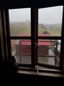
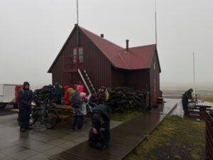
Our lodging for the night, Hólaskjól, was more of a bunkhouse than a hut which we shared with several other groups. We had hot showers and electricity so were able to charge up our devices and batteries. There was some extra space though so we each had the space that would have been taken up by 2 or 3 people when at capacity. My phone registered 9.5 miles today.

Day 7: 5 Skælingur hut to Álftavötn hut
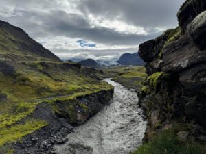
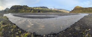
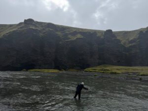
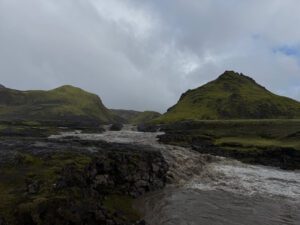
It rained all night and into the morning. The forecast was for the rain to stop late morning. This was slated to be a short day so our guide decided we’d have lunch and then set off for the next hut in the afternoon. I took advantage of the down time to rest in my bunk as much as possible. We had two more river crossings today. The first river was higher than the guide expected, but we made our way across it as one group with our arms linked together. It was just a short walk to the second crossing so we left our water shoes on. When we got to the second crossing, we found that it was impassable. Not only was the water level high and running pretty fast, but the normally clearish water had turned brown so you couldn’t see where you were stepping.
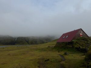
We turned around and had to back-track quite a bit to follow a dirt road up and over a hill to the next hut. Our short day turned into a more normal distance day (8.7 miles) and we arrived at the next hut (Álftavötn) around 6:00 pm along with the wind and rain. This hut was located just up the shore from a secluded lake with a stunning waterfall. We only saw the lake and waterfall for 5 minutes or so before the weather closed in around us. We were the only group at this smallish hut so had some room to spread out. Even though it is advertised to have space for 20, it would have been much more cramped if we were a group of 12 instead of 8. As it was, we had to be very strategic about where to place all our wet gear.
Day 8 & 9: Álftavötn hut to Strutur hut
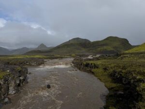
Day seven was the longest day and should have been breathtaking as the planned path took us across several pristine river valleys with amazing views and the possibility of stopping at a remote thermal pool about 45 minutes to an hour before reaching the next hut. We, however, saw nothing as the rain and low clouds persisted all day. Despite our shoes and socks being wet through, our guide insisted that we put on water shoes or walk bare foot like she was going to do as we made our way across large sections of moss and a wide alluvial plain. It appeared that the water level was higher than usual as our guide put her water shoes on after gingerly walking over rocks for a few minutes and we walked through countless rivulets and streams. The wind started picking up around 2:30 so we walked through strong winds and gusts that push you around and sheets of sideways rain until we arrived at the next hut at 5:40 pm. When we arrived at Strutur hut there were just 4 bike riders that were there seeking refuge, but we were told that the hut was scheduled to be completely full that night. We were optomistic that no one else would be able to reach the hut in the terrible weather and proceeded to spread out our stuff. Unfortunately we were wrong and a large group of French tourists arrived by 4wd vans about an hour later, requiring everyone to sleep like sardines in the upstairs bunk area.
The rain and wind continued all night and into the next morning. I pulled a weather report from my Garmin InReach satellite device and saw that it was forecasting for 4.3 inches of rain with 30 mph winds all day. Another inch of rain was expected the following day, but the rain and wind was forecast to abate around 10:00 am the following morning. Our guide was also getting weather reports from somewhere and he delayed our starting time twice before abandoning the plan to go anywhere that day. It was a long day of being shut in the hut with so many people. I was generally feeling better, but still a bit tired and had a bit of a dry cough so I took advantage of the down day and took a couple of naps. We didn’t have much for dinner as we had eaten most of the food the night before and our supplies for dinner that night were at the next hut. Our guide scraped together enough to make a kind of tomato soup with some extras. I supplemented my dinner with a granola bar or two and then turned in hoping that the weather would clear overnight.
Day 10: Strutur hut to Emstrur hut
We were now a day behind schedule and our next hut reservation was at a hut that was originally scheduled as a two day walk. We had a long way to go and most of our food was at the next hut so our guide said that we’d have breakfast at 5:30 and start hiking around 6:30am so that we could get to next hut for lunch. Once there, we would have the previous night’s dinner for lunch and then move on to scheduled hut for dinner. It was still raining when we woke, but the winds had died down a bit. We packed up as quietly as we could and ate a little breakfast quickly so trying not to disturb the other groups who were still sleeping. It took people a while to get ready, but we set off into the clouds and rain at about 7:20 am. Most of our gear had pretty well dried out except our socks and shoes. While most people had dry socks, I think most people elected to rewear wet socks since our boots were still wet and it was likely that they’d get even wetter.
Thankfully the wind had died down so we didn’t have to contend with that. But we had another large river valley to cross after ascending a low ridge, and it was no surprise that the water levels in this valley were also higher than normal. This time we didn’t bother with changing into our water shoes. Whether in the interest of making time or realizing that our shoes were already soaked through, our guide just forged ahead in working her way across this unmarked valley. Part way through the valley the clouds started to lift a bit and we were able to catch a glimpse of our stunning surroundings.


We made it to a hut as we rejoined the Laugevegur trail and stopped for lunch. There we learned that the storm had been so strong that it had also stranded many hikers on the Laugavegur trail. We heard that one hut had over 100 people sheltering in it because people in the hut couldn’t leave to cross a river and new hikers continued to arrive. Once the storm let up, multiple specially outfitted buses were sent from Reykjavik and with the help of search and rescue many hikers were evacuated from the trail. It also took a while for people to figure out where our group was as the wardens at the hut we were stuck in told us that they had informed people that we were staying there, but the people in the hut we were expected at (Alftavatn), and the other Amorak guide apparently didn’t get the message. In any case, things got sorted out and our box of food was brought from Alftavatn and taken to another hut (Hvangil), which was a bit closer and not blocked rivers. In any case, we had a bit of a rest and then sat down for a large hot lunch.

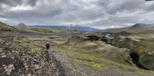
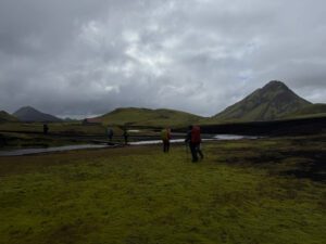
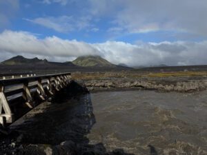
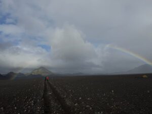
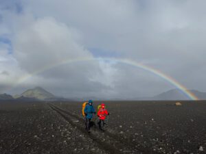
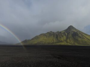
After lunch, we cleaned up and then got ready to continue our trek to Emstrur hut. The other Amorak guide came out to check on us as the group he was guiding had finished their hike the previous day and he was in the general area. There were a couple of swollen river crossings that blocked our way and he was able to drive us across in the larger 4wd van. There were a couple people in our group that wanted to get a ride to the next hut and it seemed that many of the others were indifferent. I expressed a desire to walk since the weather was finally clearing and I wanted the experience. Our guide said she was happy to walk and a few other people indicated they would also walk. When we got across the two rivers, the weather was clearing and the other Amorak guide encouraged everyone to walk the next section of trail because it was so pretty. I think he kind of shamed the two people who wanted a ride into walking, but in any case we all set out walking to the next hut. It was a beautiful afternoon with a rainbow appearing and following us for quite a while. Even though we had connected with the Laugavegur trail, we saw only four other people the entire afternoon. We made it to the next hut at around 7:00pm and it too was eerily deserted as a result of the prior days evacuation. Even though, there were three separate huts this location that each could hold about 20 people, our group of 9 was the only group there that evening. My phone registered just under 15 miles of walking for the day..

Day 10: Emstrur hut to Langidalur hut
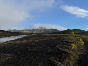
Our last day of hiking was a nice day. The trail was still pretty deserted as we seemed to be the only group hiking south. There were some tent campers who were hiking north, and there was a solo backpacker that past us toward the end of the day. The trail today skirted below a couple arms of the Myrdalsjokull glacier and crossed over a deep canyon with a glacier fed river. Toward the end of the day we crossed another glacier fed river that was still a bit higher than normal and then entered the Thorsmark valley, where we started seeing larger bushes and small trees. We arrived at the Langidalur hut around 4:30 after walking a little over 11 miles for the day.
Langidalur is a larger hut (capacity of 75) with several different sleeping rooms. There were more people around and the dining area got quite crowded, but we had a small room for our group so we had a bit of extra space. I think many of the other groups were doing other hikes in the general area because we hadn’t seen them out on our trail. I think people in our group were ready to be done with hiking by the time we finished.
We had a relaxed morning the next day, with a driver and 4WD van arriving around 11:00 for the return trip to Reykjavik. We arrived back around 2:00 pm and I had about a 20 minute walk to the hotel where I was meeting Angie. The plan was for us to pick up a rental car the next morning and start out on a 12 day self drive around Iceland’s ring road. Angie had brought a covid test with her so I could test before we continued on our journey and confirm that I didn’t have covid. I thought for sure I’d be negative as I was feeling fine by then and I’d never felt all that bad. The test however, came back positive. I quickly messaged Angie and then vacated the hotel room as quickly as possible while we figure out what to do.