Section L northbound: 90 miles, Elevation gain/loss +19690/-18380 ft. July 7-12, 2025

Day 1: 15.5 miles +2,948/-3,407 ft. Rainy Pass to S. Fork Methow River
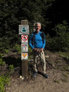
Chris and I left Seattle early in the morning for the 2 1/2 hour drive up to Rainy Pass. My goal was to start hiking mid-morning and to go as far as made sense. Chris would continue on east on his way back home to Montana. The weather continued to hold though the forecast was for clouds and possible rain in a couple of days. I was feeling physically good after our first five days out, but I was a bit apprehensive about heading out solo. It had really enjoyed hiking with Chris and was wondering how long it would take to adjust to hiking solo. Chris dropped me at the northbound trailhead at Rainy pass, we said a quick goodbye and off I headed. I surprised myself at how quickly I adjusted to being alone. Within an hour or so, I felt like I was back into the rhythm of solo hiking and reminiscing about the previous year’s trip. I also quickly started crossing paths with other solo hikers who were starting out on hiking the entire Pacific Crest Trail southbound. Unlike the section we had just completed where we saw very few through hikers and mostly ran into couples or groups on shorter trips for the long 4th of July weekend, I was seeing mostly solo hikers that were beginning a 2,650 mile journey.
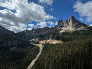
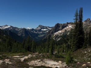
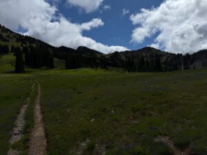
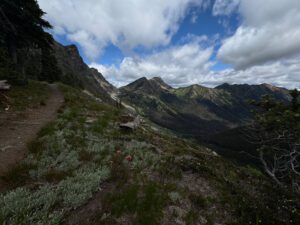
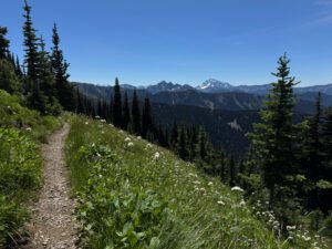
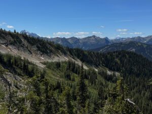
After an initial gentle climb through the forest, I left the trees and crossed over Cutthroat Pass. The North Cascades were stunning, with the terrain seeming just a little more rugged and wild than the section I had just finished. Once I left the trees, the temperature warmed up quickly and there wasn’t much shade.
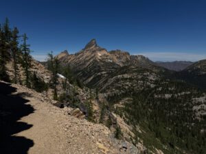
From Cutthroat pass the trail dropped down a bit and then climbed again as the trail contoured along the ridge. There were several spots that where the trail was cut across a shale slope that was a bit sketchy, but I figured I wasn’t the first person to cross the sections this season and if other people had made it, so could I.

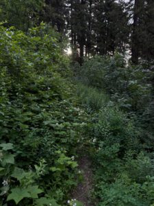
While I was sad to lose the views, I was happy to cross Methow Pass and descend back into the cool forest. I met two forest service workers who were caring a chain saw and can of gasoline and were working to clear the trail of trees and other blow-downs. They were happy when I told them there weren’t many obstructions in the trail back to Rainy pass and said they were planning to exit at Rainy Pass the following day. I continued on until I reached the Methow river and set up camp. I talked to a few through hikers and helped one find his friend who was camped on the other side of the river.

Day 2: 18.9 miles +4,377/-2063 ft. Methow River to trailside campsite south of Buffalo Pass
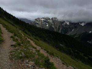
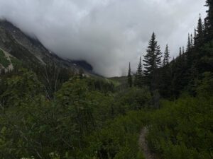
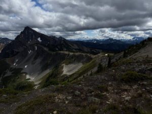
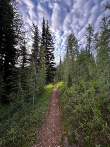
Today started with a walk through overgrown brush to aptly named Brush Creek and then a long climb up to Grasshopper Pass. The day started with broken clouds and progressively got cloudier and cooler. I didn’t see many people all morning and enjoyed the solitude. I did have some views on the section from Grasshopper pass to Hart’s pass although they weren’t as good as the day before. It was on this section in the mid-afternoon that I met a solo day hiker. I asked him where he was headed as I was a bit surprised to see a day hiker headed away from Hart’s pass at this time of day and he said he was head to the ranger station. I was confused and asked him where the ranger station was that he was headed to. It took a while, but I finally figured out that he thought he was headed to Hart’s Pass, and he didn’t believe me at first when I told him he was headed the wrong way. I finally convinced him and he turned around and hastily made his way back the way he had come. I lost sight of him after 20 minutes or so. I made it to Hart’s pass and talked with the volunteer ranger a bit. At first she wasn’t particularly friendly and seemed annoyed that I asked her where the northbound trailhead was. She said something along the lines of “I already told you where the trail started.” I then figured out that she had mistaken me for someone else and once I convinced her that I was a different person, her attitude changed and she was very helpful. I then left Hart’s pass with the goal of making it several more miles before setting up camp. The weather continued to deteriorate and I ended up finding a spot that provided a bit of a wind break so I could pitch my tent and heat some water for dinner. I was joined later in the evening by a solo through-hiker who pitched her tent a short distance from mine. It was a wet and windy night. The wind stopped by the next morning, but I was in the clouds and packed up a wet rainfly.

Day 3: 20.7 miles +4124/-4575 ft. Trailside camp to Hopkins Lake
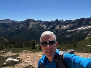
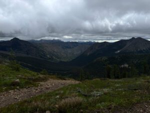
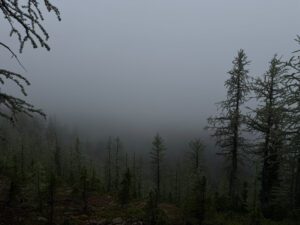
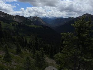
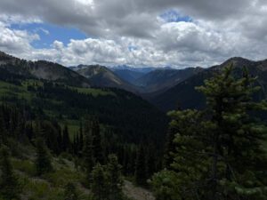
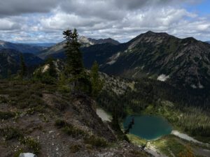
This morning started in the clouds and I walked for several hours wondering what scenery I was missing. This was particularly true when I was traversing the mountain side as I could see the hillside slope away but all I could see was grey. Since I was now on the same trail that I would be on when I returned to Hart’s Pass from the Canadian border, I was hopeful that the weather would clear and that I’d be able to see what I had missed. As luck would have it, the weather started to clear by late morning and I enjoyed beautiful weather for the remainder of the trip.
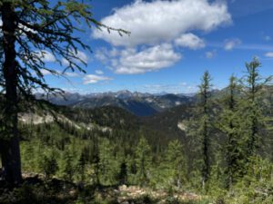
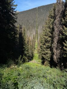
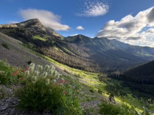
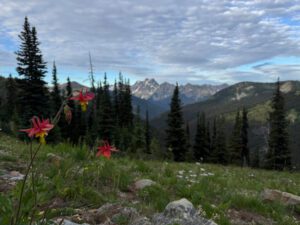
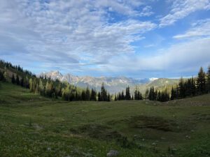
Once the weather cleared the hiking was gorgeous. The trail descended into a valley and then climbed back out and crossed a high alpine meadow before dropping back down a bit and then climbing over Woody Pass, crossing over the highest point of the PCT in Washington and then dropping down to Hopkins lake. From Hopkins Lake it’s just a 6 mile descent to the border. As I was making one of the first descents of the morning, I passed by an older guy taking a rest on a fallen tree looking at a paper map. I stopped to talk with him and figured out he was the person that the volunteer ranger had confused me with. Apart from the grey hair, I didn’t think we looked at all a like, but I suppose, to many people on first glance we both were just old grey-haired men. In any case, I learned that he was a few years older than me and that he lived in Wisconsin and was on his second day hiking the entire Pacific Crest Trail, which he’d been planning to do for several years. He complained about a bad knee and remarked that they don’t have mountains like this in Wisconsin! I told him to take it slow and that he’d soon get his trail legs and wished him well. I wondered when I’d cross paths with him again and thought to myself that he had a very long journey ahead of him. As it turned out, I saw him again on my last morning and we were both headed in the same direction back towards Hart’s Pass. The poor guy only made it to shortly before Woody Pass before calling it quits. He said his knee was really bothering him and that he was quitting. I suggested that he might want to take some time back in town to rest up a bit and then tackle a slightly easier section. But he seemed pretty set that his dream of a 2650 mile through hike was over after just 30 miles.
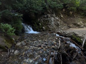
One other thing of note on this section of trail is that there were several long stretches without water. I pretty much ran out of water once mid-day and started paying close attention to where water was available.

Day 4: 17.8 miles +3216.2/-3,100 ft. Hopkins Lake to Canada and back to Woody Pass
The six miles from Hopkins Lake to the Canadian border is all down hill. In fact the trail loses a little over 2,000 vertical feet in that section. While that made for a easy morning hike to the border, no one likes the hike back. In past years there was the option of continuing north and exiting at Manning provincial park in British Columbia, but Canada stopped allowing people to enter Canada from the PCT in 2025. Many people “slack pack” to the border. That is they leave their tent, sleeping bag, pad, and food behind and just take what they’ll need to get to the border and back to camp. That sounded like a good idea to me, so that’s what I did. There was lots of water on the trail between Hopkins lake and the border so I didn’t worry about carrying water with me. Though I did filter three liters of water at the last reliable stream before returning to my campsite at Hopkins lake. I didn’t want to get water at the lake because it was a bit of a walk from my campsite and the water wasn’t as good as it was in snow melt fed streams.

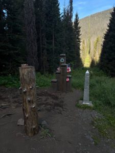
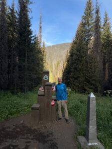
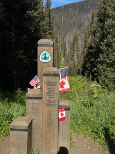
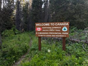
It was fun for me to be at the norther terminus and to think about how it must feel for people that are starting or ending their PCT through hike. It really is an amazing trail and accomplishment to all who have completed that journey.
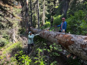
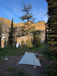
After leaving the monument, I returned to my campsite, packed up and started to make my way back to Hart’s pass. A couple miles before I got to my campsite I ran across a small trail crew from Methow Valley trail club that were clearing blow downs. Unlike the forest service crew I saw earlier this crew was using a two man crosscut saw and were tackling a large tree. They stopped to allow me to climb over the tree and two of the member posed for a picture while the third really didn’t want his picture taken. I made it as far as just pass Woody pass and made camp fairly early to enjoy the view from the campsite.

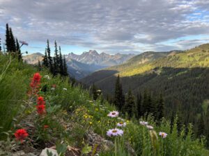
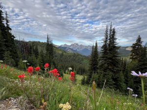
Day 5: 13.4 miles +3,065/-2,896ft. Woody Pass to campsite between Foggy Pass and Windy Pass
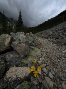
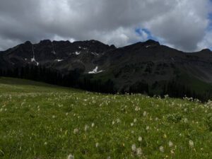
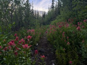
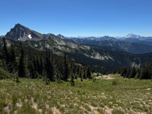
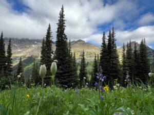
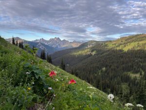
I tried to take is slow today and soak in the views and nice weather. I enjoyed passing the seemingly endless fields of wild flowers and looking at the ever changing mountain views. I didn’t need to cover as much ground as I had in past days as I wanted to stop short of Hart’s pass. I remembered seeing what looked like a nice campsite on the way up to the terminus and thought I could find it on the way back. I don’t think I actually found that campsite, but I stopped about 5 miles short of Hart’s pass at what I thought would be a good site. It was fine, but turned out be pretty dusty when the wind picked up in the afternoon and there were some rather bothersome yellow jackets that thankfully weren’t aggressive. I had finished up dinner and was resting in my tent when I heard another hiker stop and start to set up his tent. I ventured out of my tent after a while and stuck up a conversation with him. The more we talked the more I got a feeling that I had crossed paths with him before. I asked him a few more questions and realized that I had met him on the trail last year. We had stopped to talk for a bit as he was heading north and I was heading south. He had told me last year that he goal was to make it to Stehekin at the north end of Lake Chelan where he was to meet his son. I had wondered last year if he made it as there were several fires that closed the PCT north of Stevens Pass. It turns out that he hadn’t and he was now headed south and planning to complete Section K after finishing up this section. I wonder if I’ll see him next year?


Day 6: 5.8 miles +863/-1209 ft. Campsite between Foggy and Windy Pass to Hart’s Pass
My goal was to make it to Hart’s pass by 10:00 am or so, so that I would have plenty of time to hitch a ride down to Mazama and meet Angie. It was a beautiful morning and I had a very pleasant trip back to Hart’s pass taking in the sights that had been obscured by clouds a few days earlier. It was a great way to end the trip.


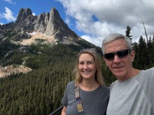
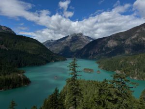
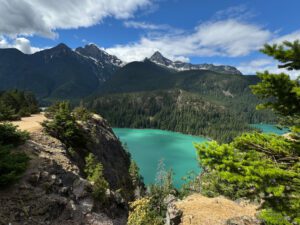
I was lucky and caught a ride with a young couple and their dog and toddler after waiting less than 30 minutes. They dropped me at the Mazama store where I enjoyed a breakfast bagel sandwich and a piece of coffee cake. I was able to get into our room at the Mazama Inn and shower before Angie arrived. It was hot in Mazama and Angie went for a swim in the pool. We had a nice drive back to Seattle the following day, enjoying the North Cascades and Diablo Lake on the way.