Distance 81.8 miles. Elevation Gain 13,370 ft. Elevation Loss 17,230 ft. – 5 days July 26-30, 2024
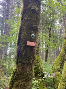
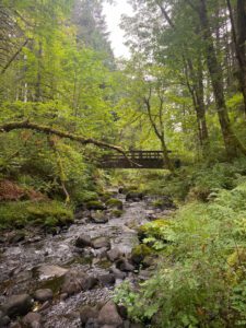
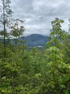
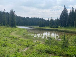
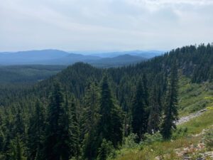
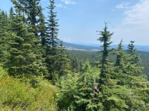
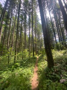
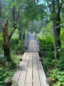
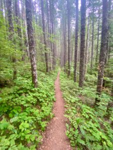
This is the southernmost section of the PCT in Washington. It is almost entirely in forests with steadily decreasing elevation hiked southbound. There are several places with potential views in this section, but it was either hazy or I was in the clouds when I reached those sections. The trail crosses several rivers on permanent bridges and felt less remote than the sections to the north, particularly in the Wind River area where the trail crossed several paved roads and ran adjacent to private property.
Day 10: Forest Service Road 23 (Trout Lake) to Mosquito Creek. 10.2 miles Total assent 1,777 ft. Total descent 1,745 ft.
I enjoyed my stay and the Trout Lake Valley Inn and had a relaxing morning. I ventured down to the included continental breakfast around 8:30 am. As I was gathering food, I met another hiker (“Tais”) who was from Vancouver B.C. and was completing the entire Washington section of the PCT and we realized we had met each other briefly back at White Pass. We ate together and made plans to share a ride out to the trailhead later that morning. We both were planning a relatively short day so there wasn’t a need to start hiking earlier than mid-day. I enjoyed a bagel and cream cheese, an old fashion donut, three hard boiled eggs, various fresh fruit, two glasses of orange juice and several cups of coffee. I probably could have eaten more, but did not want to over do it! Once we were packed up and checked-out of the Inn, we called one of the trail angels who arrived in about 15 minutes and graciously drove us up to the trailhead. When we got to the trailhead there were 4 or 5 hikers waiting for a ride into town so our driver loaded them up and took them into Trout Lake.

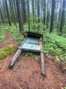
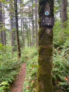
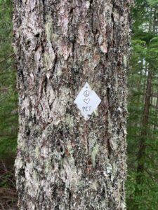
The trail began with a pretty steady incline and it wasn’t long before Tais was out of sight. We made tentative plans to camp in the same spot, but he was no where to be seen when I got there later that afternoon. We did, however, meet up again at the campsite the following day and spent a couple lunches and evenings together. The scenery today was mostly forest walks with several road crossings and one creative trail sign. While eating dinner next to mosquito creek (no mosquitoes!), I met a southbound PCT hiker. We talked for a while and I learned that he was a hydrogeologist from Portland. His trail name (through hikers are often given a trail name by people they travel with) was Rock and Roll. “Rock” because he is a geologist and “roll” because he is clumsy. I saw him again the next morning as he headed out down the trail 10 minutes or so ahead of me.
Day 11: Mosquito Creek to a couple miles south of Crest Camp. 23.6 miles Total assent 2,721 ft. Total descent 3,385 ft.
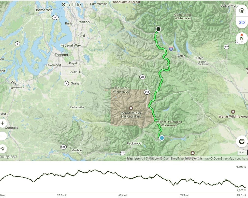
I planned to stop at Sheep Lake, which would have made this a 19 mile day. When I got to sheep lake I saw that it was really just a large shallow pond. The water didn’t look great so I figured I should keep moving until I found a better water source. That took me several miles down the trail to where a spring had been piped to trail. I filled up on water at the spring and carried it the short .2 miles to the nearest campsite. I noticed there was someone already in one of the campsites and as I got closer I saw that it was Tais. As we were catching up and I was setting up my camp another hiker came by. He was startled when I said “how’s it going Rock and Roll as he hadn’t recognized me. He set up his tent a short way away from me and the three of us had a nice time talking before turning in for the night. We were up at about the same time in the morning and I departed slightly ahead of the others.
Today’s hiking was more forests, with a couple of viewpoints where the terrain was noticeably less dramatic than it had been. The trail crossed through Indian Heaven Wilderness and passed by several lakes. While reports had been that this section was bad for mosquitoes, it was fairly breezy today and the mosquitoes were only noticeable in a couple of places.
Day 12: A couple miles south of Crest Camp to Trout Creek. 18.5 miles Total assent 2,356 ft. Total descent 4,382 ft.
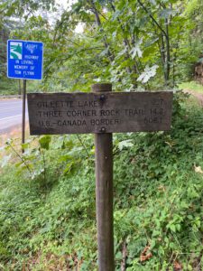
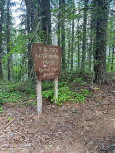
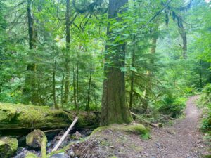
Today was another day of hiking predominantly through forests. While there was some climbing to do in the morning and just after lunch, we spent most of the time descending. The trail passed by several miles of the Wind River Experimental Forest, a section of forest, including some old growth stands that are managed by the U.S. Forest Service and preserved for various experimental purposes. As the trail descended, I started to see some oak trees and other plants associated with lower elevations. I made it to Panther creek and enjoyed a long lunch break at the side of the river. Tais and Rock and Roll arrived about 30 minutes after I arrived. While I had originally planned to camp at Panther Creek, I decided to press on to Trout Creek with them as I enjoyed their company in the evening and I was looking forward to a shorter day the next day. It would be my last night out before a long last day and I would be camping by Rock Creek, which was reported to be a good swimming hole and nice places to cool off by theriver. The three of us arrived within 15 minutes of each other at Trout Creek and enjoyed the little bit of down time before dinner and bed routines. Several other hikers arrived as it was getting dark such that it seemed like all available campsites were taken. In general the trail seemed to be getting busier.
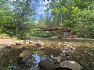
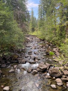
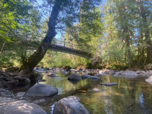

Day 13: Trout Creek To Rock Creek. 10.5 miles Total assent 2,467 ft. Total descent 2,270 ft.
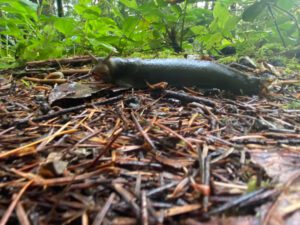
We woke to an overcast morning and were on the trail be 7:00 am. Someone had checked the weather and reported that there was a 40% chance of rain from 9:00 am to about 3:00 pm. I knew I wasn’t going beyond Rock Creek today so set off on the climb out of Trout Creek basin with a nice leisurely pace. It was a cool morning and I noticed many banana slugs along the trail. Sure enough, it started to drizzle on and off around10:00 am. I arrived at Rock Creek around noon and met up again with Tais and R&R who were taking a lunch break by the water. I found a nice spot by the creek to set up camp and it started to drizzle in earnest around 12:30. Tais and R&R set off again as they wanted to get further up the trail. I stayed at Rock Creek and set up my tent. It kept raining so I reluctantly abandoned my plan of spending the afternoon lounging by and in the creek and instead crawled into my tent and took a little nap. It rained all afternoon and finally started to let up around 5:00 pm. I took advantage of the reprieve and made dinner. As I was finishing up, it started to rain again. It drizzled/rained all night. It was the first real rain test for the tent and I’m happy to report that it kept me dry and also did a good job of sheltering my gear.

Day 14: Rock Creek to Cascade Locks. 19.1 miles Total assent 3,362 ft. Total descent 4,677 ft.
It was still drizzling when the sky started to brighten. I was ready to get going and packed up what I could while under the cover of the rain fly. I rearranged things a bit so I could pack my wet rainfly and ground sheet in an outside pocket and made sure things that I wanted to stay dry were packed inside the waterproof liner in my backpack. Everything worked as planned, though the wet gear make my pack heavier than it should have been at that point. There wasn’t anything to be done about the wet gear so off I went. It finally stopped drizzling around 10:30 or 11:00, though my legs and feet were soaked from brushing up against the wet vegetation that was growing over the trail in many places. I had been looking forward to this section of the trail as it is reported to have good views back to Mt. Adams and forward to Mt. Hood, but there were no views to be had today. It was colder and wetter the higher I went and soon enough I was in the clouds. I was happy to drop down out of the clouds and the trail became noticeably dryer as I got closer to the Columbia River.
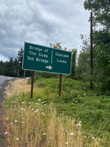
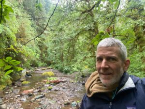
I stopped by a creek about 4-5 miles from the end of the hike to change and wash my old socks and put on a new shirt so I would be presentable when Angie met me. I crossed the Columbia river around 3:30 p.m. and was able to dry my rainfly and other gear as I waited for Angie to arrive. I also talked with aForest Service person who was stationed at the trailhead to inform people that the PCT was closed heading south into Oregon due to a recent fire. It’s been such an early fire season this year (2024). The northern section of Washington had been closed for a week or so in two places due to fires and there were also closures in northern California and southern Oregon. It felt good to have completed the southern half of Washington and it felt like I had traveled a long ways in just two weeks. I was also looking forward to reentering the world of real food, soft beds and warm showers.