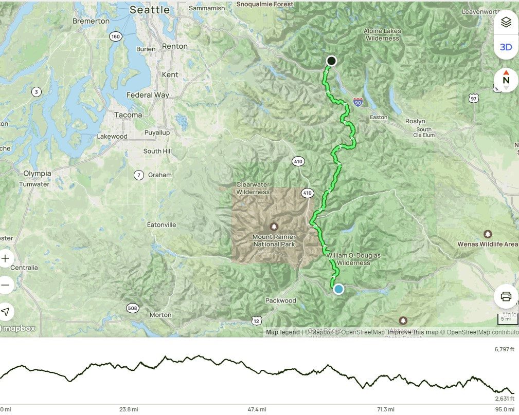
65 Miles. Elevation Gain 10,730 ft. Elevation Loss 11,100 ft. – 3 1/2 days July 22-25, 2024
IThis is section is really just a portion of Washington section H, but the full Section H is 146 miles so most people stop and resupply at Trout Lake. In addition, I didn’t stay at White Pass so I was on my 9th day of hiking and was very ready for a little respite by the time I got to Trout Lake.
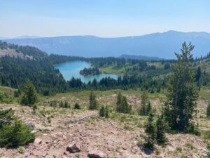
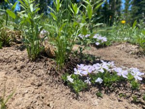
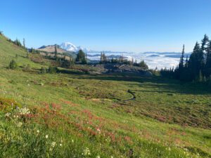
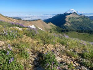
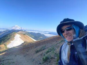
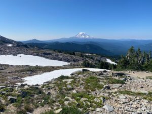
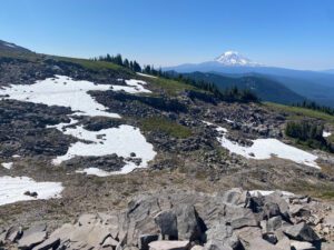
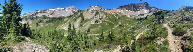
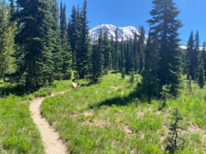
While this is a relatively short section at just 65 miles, it was the prettiest of the three southern sections I completed. Some say it is their favorite section in Washington. The trail crosses through the spectacular Goat Rocks Wilderness, crosses alpine streams and provides views of Mt. Tahoma (Rainer), Mt. Saint Helens and skirts around the base of Mt. Adams affording up close views of that volcano.
Day 6: White Pass to Pass to second to last campsite before Knife’s Edge. 15.2 miles Total assent 3,991 ft. Total descent 2,408 ft.
I woke early, broke camp and walked the 1/2 mile up the road to the White Pass store to resupply. I had sent a box of food ahead and just had to wait for the store to open at 8:00 am to collect it. The store owners really cater to PCT hikers as they have facilities to shower, do laundry, and have stocked the store with items that through hikers might need. They also set up several picnic tables with power strips, a sink with running water, and free wifi behind the store. I was happy to catch-up on news and email while charging my phone and back-up battery and waiting for the store to open. It was also nice to talk to Angie on the phone and catch-up on the latest news. Soon enough, the store opened, I paid the $10 to retrieve my box and packed-up for the next section. I was looking forward to a hot breakfast, but the food at the store was deep-fried and did not look appetizing so I passed and walked back down the road to the trailhead. I was back on the trail by 9:30 am.
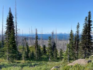
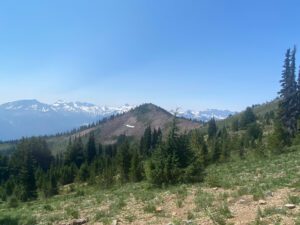
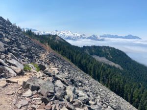
The trail began climbing immediately and was forested until it broke out of the forests near the top of the chair lifts for the White Pass ski slopes. The initial views, while nice, were obscured by wild fire smoke. I was somewhat resigned to having hazing views for the duration of the trip, but was pleasantly surprised when the wind picked-up in the afternoon and blew the smoke away. The couple days of clear weather I had before smoke returned could not have come at a better place on the trip.
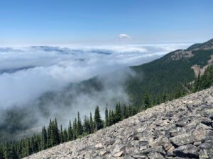
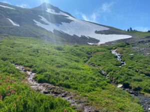
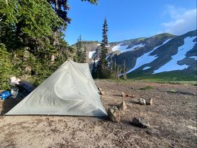
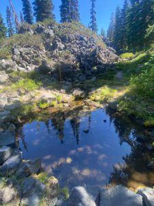
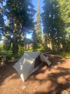
I was really tired by the time I made it to my planned campsite and enjoyed a well-deserved break by watching the clouds move in and out over the mountain tops. I enjoyed the windy weather until it was time to pitch my tent. It was then that I realized that most of the flat spots were hard rock and that I would be unable to stake my tent into the ground. This was my first trip with a non-freestanding tent and I really struggled getting it pitched. The end result wasn’t pretty, with a corner of the tent remaining pretty loose. It banged around all night in the wind and I wasn’t sure if my pitch would hold through the night. I spent a good portion of the night helping secure the tent from the inside. It was so windy in the evening that I didn’t even try to light my stove to have a hot dinner. It was one of my worst nights sleeping while backpacking with sustained winds all night long and gusts that had to have been at least 40 mph and likely stronger.
Day 7: Goat Rocks Knife’s Edge to south of Walput Lake trail junction. 19.2 miles Total assent 3,211 ft. Total descent 4,042 ft.
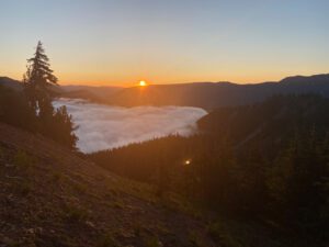
I was happy when the sky started getting lighter and had packed up, watched the sunrise, eaten breakfast and was walking by 6:30am. The wind had died down so there was just a light breeze. The air was crisp and the sky was clear. It was a beautiful morning.


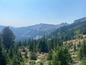
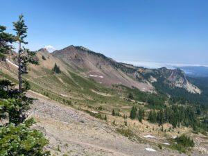
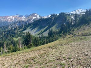
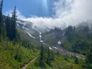
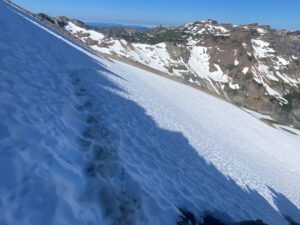
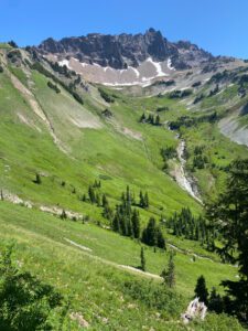
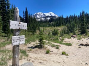
The trail eventually got to the section that I think is called the knife’s edge which required several snow crossings. There was also an alternate trail that was a bit longer and went up and around the snow traverses. These traverses were some of the scarier ones that I’ve done and required total focus. I would have been nice to have my micro-spikes with me, but I was made it across the three sections without slipping. There were also a couple of patches of loose shale that I thought were actually more iffy than than the snow patches.
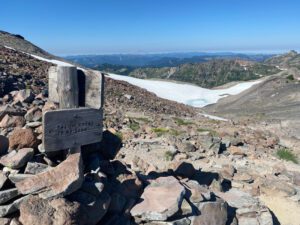
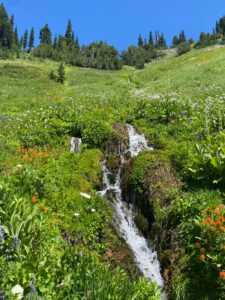
The trail then dropped down and headed to the south and east while hugging the side of mountain. It then climbed up over Cispus pass, which offered more stunning views and dropped down the other side eventually re-entering forest.

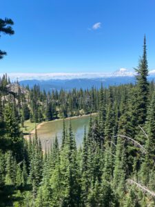
Day 8: South of Walput Lake trail junction to a mile south of the Lewis River headwaters. 20.3 miles Total assent 3,104 ft. Total descent 2,388 ft.
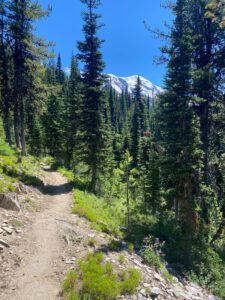
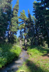
Today’s walking returned mostly to forest walking as the trail approached and then traveled around the base of Mt. Adams. I started to see more northbound PCT hikers today. Some had skipped sections in California or Oregon because of early season fires, but several had made it all the from the Mexico border and had been hiking since April. In general, I was impressed that people on the trail were happy to be out hiking even when the conditions weren’t ideal and most people were quite friendly and willing to stop and talk for a bit.


Day 9: South of the Lewis River headwaters to Forest Service Road 23 (and resupply at Trout Lake). 11.3 miles Total assent 610 ft. Total descent 2,610 ft.
Today was a short day with little elevation gain. It was a cold night and I was quite cold hiking in the morning. I was also surprisingly tired as even the small uphill sections bogged me down. I arrived at the Road late morning and was welcomed by a trail angel who had brought donuts, fruit, smoothies, and various other food to give to PCT hikers. There is a loose network of volunteers that help people hiking the PCT by giving them rides to resupply spots, offering places to stay, and showing up at various trailheads with treats. The volunteers are “trail angels.” When food shows up at trail heads it is “trail magic.” The small town of Trout Lake is 13 miles down FS road 23, but the town has a pretty organized staple of volunteers who offer rides to hikers into town and back out to the trailhead. They maintain a website listing the PCT resources available in town, https://troutlake.org/pct-trail-angels/.
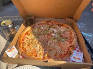
The Trout Lake general store also stocks supplies for hikers and will hold resupply boxes for hikers free of charge. There are showers at a local county campground and several people that offer places for hikers to sleep. I had sent a resupply to the Trout Lake General Store so I called one of the volunteers and 20 minutes later a retired gentleman showed up in a crew cab pickup truck. He loaded 9 people and gear into his truck (4 inside, 5 in the back) and drove us into town. I decided that I could really use some cleaning up and rest time, so I booked a room at the Trout Lake Valley Inn, picked up my supply box and got a ride to the Inn. Once I got into the room, I realized just how tired I was. I showered, washed my clothes in the sink and took a blissful nap on the bed. I didn’t do much else until it was time for dinner, then I walked across the street to Mt. Adams pizza and devoured one of the best tasting pizzas I’ve ever had!